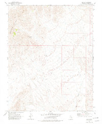
1969 Map of Vigo NE
USGS Topo · Published 1982About this map
The Meadow Valley Mts dominate the northwestern portion of this high-desert landscape in Lincoln County, where the terrain transitions into complex drainages and canyons. Significant for its water management in an arid environment, the Avertt Reservoir sits tucked within the western slopes, likely serving local ranching or wildlife needs of the late 1960s. To the south, Vigo Canyon cuts through the desert floor, providing a natural corridor through the difficult topography. The network of several paths marked as Jeep Trail suggests a region defined by limited access and utilitarian travel, typical of the remote Nevada interior during this period of geological study.
Find a feature on this map
5 named features on this map. Tap any name to fly to it.
Don’t see what you’re looking for? This feature index may not catch every label — zoom into the map to look around manually.
Map Details
Editions of this 1969 Vigo NE Map
2 editions found
Other maps of this area

1885 · Pioche
USGS Topo · 1:250,000

1886 · Pioche
USGS Topo · 1:250,000

1954 · Caliente
USGS Topo · 1:250,000

1959 · Caliente
USGS Topo · 1:250,000

1969 · Vigo NW
USGS Topo · 1:24,000

1969 · Elgin
USGS Topo · 1:24,000
1969 · Vigo
USGS Topo · 1:24,000
1969 · Sunflower Mtn
USGS Topo · 1:24,000
1969 · Vigo NE
USGS Topo · 1:24,000

1969 · Elgin SW
USGS Topo · 1:24,000