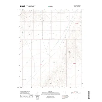
2018 Map of Vigo NW
USGS Topo · Published 2018About this map
Kane Springs Valley dominates the western half of this Lincoln County landscape, showing the arid basin-and-range topography characteristic of southeastern Nevada. In the northeastern corner, the land rises into the southern reaches of the Meadow Valley Mountains, where deep drainages like Hackberry Canyon carve through the high ground. The area's limited water sources are critical landmarks, including the namesake Kane Springs and Sunflower Spring situated along the mountain slopes. This 2018 survey detail provides a clear view of the Kane Springs Wash as it threads through the valley floor, highlighting the natural drainage patterns that define movement and survival in this desert environment. The map provides essential data for those studying the intersection of the Meadow Valley range and the broad alluvial plains of the valley.
Find a feature on this map
10 named features on this map. Tap any name to fly to it.
Don’t see what you’re looking for? This feature index may not catch every label — zoom into the map to look around manually.
Map Details
Editions of this 2018 Vigo NW Map
This is the sole edition of this map. No revisions or reprints were ever made.
Other maps of this area

1885 · Pioche
USGS Topo · 1:250,000

1886 · Pioche
USGS Topo · 1:250,000

1954 · Caliente
USGS Topo · 1:250,000

1959 · Caliente
USGS Topo · 1:250,000

1969 · Vigo NW
USGS Topo · 1:24,000
1969 · Delamar 3 SE
USGS Topo · 1:24,000

1969 · Gregerson Basin
USGS Topo · 1:24,000

1969 · Delamar 3 NE
USGS Topo · 1:24,000

1969 · Elgin
USGS Topo · 1:24,000
1969 · Vigo
USGS Topo · 1:24,000