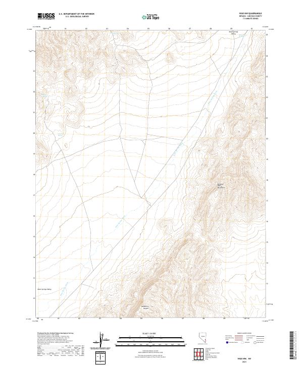
2021 Map of Vigo NW
USGS Topo · Published 2021About this map
Kane Springs Valley defines the landscape of this Lincoln County region, where the broad desert basin meets the rising slopes of the Meadow Valley Mountains. The topography is shaped by the drainage of Kane Springs Wash, which cuts diagonally across the quadrangle, and the deeply incised Hackberry Canyon to the south. Though largely an arid expanse, the map identifies critical water sources essential for navigation and cattle ranching in the high desert, including Kane Springs, Stewart Spring, and Sunflower Spring. These isolated points of water, along with Live Oak Spring, reveal the historic importance of reliable springs in an otherwise unforgiving environment, providing the necessary landmarks for those traversing the eastern Nevada interior during the early 21st century.
Find a feature on this map
12 named features on this map. Tap any name to fly to it.
Don’t see what you’re looking for? This feature index may not catch every label — zoom into the map to look around manually.
Map Details
Editions of this 2021 Vigo NW Map
This is the sole edition of this map. No revisions or reprints were ever made.
Other maps of this area

1885 · Pioche
USGS Topo · 1:250,000

1886 · Pioche
USGS Topo · 1:250,000

1954 · Caliente
USGS Topo · 1:250,000

1959 · Caliente
USGS Topo · 1:250,000

1969 · Vigo NW
USGS Topo · 1:24,000
1969 · Delamar 3 SE
USGS Topo · 1:24,000

1969 · Gregerson Basin
USGS Topo · 1:24,000

1969 · Delamar 3 NE
USGS Topo · 1:24,000

1969 · Elgin
USGS Topo · 1:24,000
1969 · Vigo
USGS Topo · 1:24,000