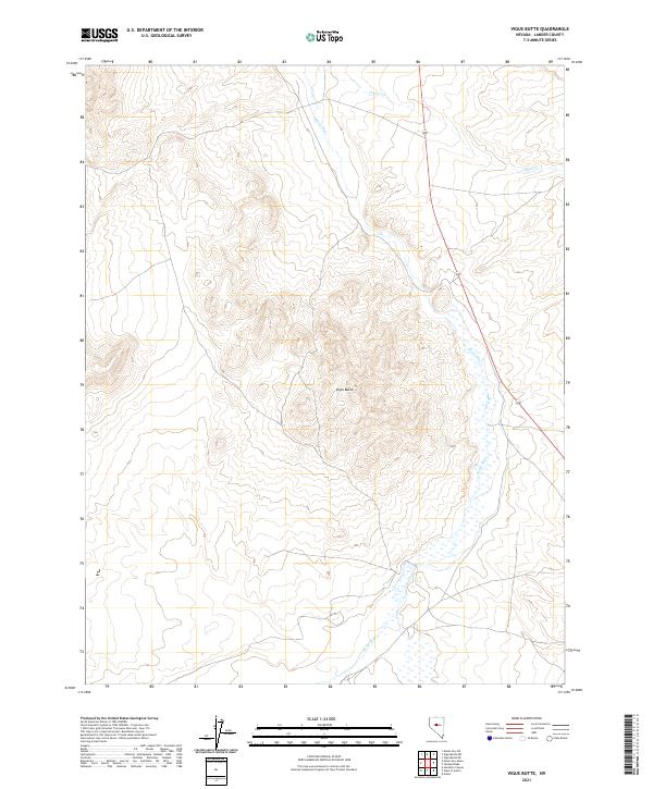
2021 Map of Vigus Butte
USGS Topo · Published 2021About this map
Vigus Butte stands as a prominent elevation in this high-desert region of Lander County, overlooking the expansive drainage system of the Reese River. The landscape is characterized by the river's seasonal flow and the smaller drainage of Italian Cr to the north, which together define the hydrological character of the basin. The survey clearly delineates the Public Land Survey System (PLSS) grid, showing the boundaries between t20n r43e, t20n r42e, t19n r42e, and t19n r43e. This network of section lines highlights the orderly division of the Nevada interior, providing a framework for understanding land tenure and topography in an area where water sources like the Reese River remain the primary geographical anchors for any historical or modern activity.
Find a feature on this map
7 named features on this map. Tap any name to fly to it.
Don’t see what you’re looking for? This feature index may not catch every label — zoom into the map to look around manually.
Map Details
Editions of this 2021 Vigus Butte Map
This is the sole edition of this map. No revisions or reprints were ever made.
Other maps of this area

1955 · Millett
USGS Topo · 1:250,000

1956 · Austin
USGS Topo · 1:62,500

1959 · Millett
USGS Topo · 1:250,000

1969 · Yankee Blade
USGS Topo · 1:24,000

1969 · Vigus Butte NE
USGS Topo · 1:24,000

1969 · Vigus Butte
USGS Topo · 1:24,000

1969 · Vigus Butte NW
USGS Topo · 1:24,000

1969 · Mount Airy NE
USGS Topo · 1:24,000

1969 · Gandolfo Canyon
USGS Topo · 1:24,000

1969 · Mount Airy Mesa
USGS Topo · 1:24,000