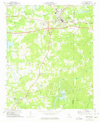
1973 Map of Villa Rica
USGS Topo · Published 1975About this map
Villa Rica serves as the focal point of this West Georgia landscape, situated along the Southern railroad line where the industrial and residential character of the town meets the rolling rural terrain of Carroll and Douglas counties. The map captures a moment of infrastructure development, noting roads under construction and a web of pipelines cutting across the countryside. To the south, the terrain is defined by the headwaters of the Dog River and Crawfish Creek, alongside man-made water bodies like Treasure Lake and Willis Lake.
Find a feature on this map
64 named features on this map. Tap any name to fly to it.
Don’t see what you’re looking for? This feature index may not catch every label — zoom into the map to look around manually.
Map Details
Editions of this 1973 Villa Rica Map
3 editions found
Other maps of this area

1889 · Tallapoosa
USGS Topo · 1:125,000

1891 · Marietta
USGS Topo · 1:125,000

1892 · Tallapoosa
USGS Topo · 1:125,000

1895 · Marietta
USGS Topo · 1:125,000

1897 · Marietta
USGS Topo · 1:125,000

1897 · Tallapoosa
USGS Topo · 1:125,000

1901 · Marietta
USGS Topo · 1:125,000

1953 · Atlanta
USGS Topo · 1:250,000

1957 · Atlanta
USGS Topo · 1:250,000

1958 · Rico
USGS Topo · 1:24,000