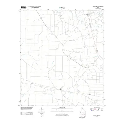
2010 Map of Village Mills
USGS Topo · Published 2010About this map
Village Creek and its many tributaries, including the curiously named Bad Luck Creek, define the landscape of this Hardin County area. The map documents several established communities and rural junctions, most notably Village Mills in the north and the cluster of Honey Island, Lelavale, and Dies along the southern corridor. The road network reveals the local history of land use, with family and descriptive names like Old Bragg Rd, Joe Allen Rd, and Holland Cemetery Rd providing clues to the region's development.
Find a feature on this map
32 named features on this map. Tap any name to fly to it.
Don’t see what you’re looking for? This feature index may not catch every label — zoom into the map to look around manually.
Map Details
Editions of this 2010 Village Mills Map
This is the sole edition of this map. No revisions or reprints were ever made.
Other maps of this area

1943 · Liberty
USGS Topo · 1:125,000

1954 · Beaumont
USGS Topo · 1:250,000

1955 · Saratoga
USGS Topo · 1:62,500

1955 · Kountze
USGS Topo · 1:62,500

1957 · Beaumont
USGS Topo · 1:250,000

1958 · Segno
USGS Topo · 1:62,500

1958 · Warren
USGS Topo · 1:62,500

1984 · Beaumont
USGS Topo · 1:250,000

1984 · Jacks Creek South
USGS Topo · 1:24,000
1984 · Saratoga
USGS Topo · 1:24,000