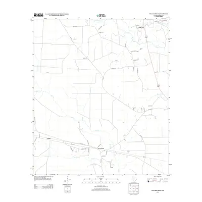
2013 Map of Village Mills
USGS Topo · Published 2013About this map
Village Mills serves as a northern anchor in this Hardin County landscape, where the dense creek networks of East Texas define the terrain. The community of Honey Island sits centrally along the corridor of FM 1293 Rd, flanked by the smaller settlements of Lelavale and Dies. These towns are deeply connected to the hydrological system of the region, situated between the winding paths of Cypress Cr and Village Cr. A web of local timber and oil access roads, such as Oilfield Loop Rd and Old Bragg Rd, crisscrosses the low-lying areas, highlighting the industrial roots of the area. For genealogists, the map preserves the locations of Holland Cem and Brackin Cem, providing essential landmarks for tracing family history in this corner of the Piney Woods.
Find a feature on this map
57 named features on this map. Tap any name to fly to it.
Don’t see what you’re looking for? This feature index may not catch every label — zoom into the map to look around manually.
Map Details
Editions of this 2013 Village Mills Map
This is the sole edition of this map. No revisions or reprints were ever made.
Other maps of this area

1943 · Liberty
USGS Topo · 1:125,000

1954 · Beaumont
USGS Topo · 1:250,000

1955 · Saratoga
USGS Topo · 1:62,500

1955 · Kountze
USGS Topo · 1:62,500

1957 · Beaumont
USGS Topo · 1:250,000

1958 · Segno
USGS Topo · 1:62,500

1958 · Warren
USGS Topo · 1:62,500

1984 · Beaumont
USGS Topo · 1:250,000

1984 · Jacks Creek South
USGS Topo · 1:24,000
1984 · Saratoga
USGS Topo · 1:24,000