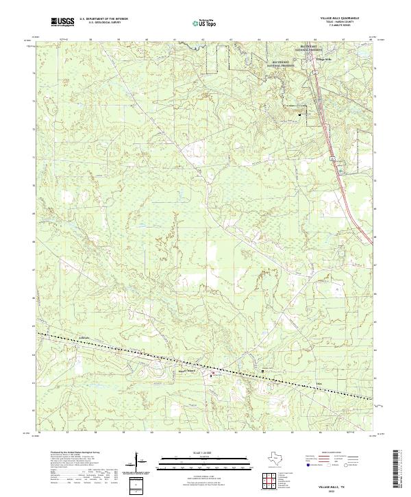
2022 Map of Village Mills
USGS Topo · Published 2022About this map
Big Thicket National Preserve anchors the northern reaches of this Hardin County landscape, where the dense timberlands of Southeast Texas meet a complex network of waterways. Small settlements and rural junctions like Village Mills, Honey Island, Lelavale, and Dies are scattered throughout the territory, connected by historical routes such as Old Bragg Rd and FM 1293. The terrain is defined by low-lying drainages including Flat Cypress Cr, Big Sandy Cr, and Village Cr, which carve through the piney woods. For genealogists, the map preserves the locations of several local burial grounds, including Holland Cem, Jordan Cem, and Bracken Cem, often situated near the family-named roads like Joe Allen Rd and Sutton Ln that trace the area's residential history.
Find a feature on this map
53 named features on this map. Tap any name to fly to it.
Don’t see what you’re looking for? This feature index may not catch every label — zoom into the map to look around manually.
Map Details
Editions of this 2022 Village Mills Map
This is the sole edition of this map. No revisions or reprints were ever made.
Other maps of this area

1943 · Liberty
USGS Topo · 1:125,000

1954 · Beaumont
USGS Topo · 1:250,000

1955 · Saratoga
USGS Topo · 1:62,500

1955 · Kountze
USGS Topo · 1:62,500

1957 · Beaumont
USGS Topo · 1:250,000

1958 · Segno
USGS Topo · 1:62,500

1958 · Warren
USGS Topo · 1:62,500

1984 · Beaumont
USGS Topo · 1:250,000

1984 · Jacks Creek South
USGS Topo · 1:24,000
1984 · Saratoga
USGS Topo · 1:24,000