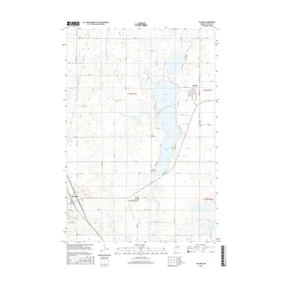
2016 Map of Villard
USGS Topo · Published 2016About this map
Villard and the outskirts of Glenwood define the human landscape of this central Minnesota region, where a chain of significant water bodies dictates the local geography. The area is dominated by the expansive Villard Lake, connected to Amelia Lake and the smaller Leven Lake to the north. These lakes are surrounded by a legacy of local genealogy, evidenced by several burial grounds including Lake Leven Cem, Saint Johns Cem, and Calvary Cem. The engineered landscape of the northern plains is visible through the extensive drainage network of Judicial Ditch Number Four and County Ditch Number Twenty-eight. In the south, the Glenwood Municipal Airport sits near the headwaters of the Chippewa River, while a dense grid of township and county roads connects the dispersed farmsteads of the surrounding townships.
Find a feature on this map
83 named features on this map. Tap any name to fly to it.
Don’t see what you’re looking for? This feature index may not catch every label — zoom into the map to look around manually.
Map Details
Editions of this 2016 Villard Map
This is the sole edition of this map. No revisions or reprints were ever made.
Other maps of this area

1953 · Saint Cloud
USGS Topo · 1:250,000

1957 · Saint Cloud
USGS Topo · 1:250,000

1958 · Saint Cloud
USGS Topo · 1:250,000

1965 · Westport
USGS Topo · 1:24,000

1965 · Sedan
USGS Topo · 1:24,000

1966 · Osakis
USGS Topo · 1:24,000

1966 · Lake Mary
USGS Topo · 1:24,000

1966 · Forada
USGS Topo · 1:24,000

1968 · Glenwood
USGS Topo · 1:24,000

1968 · Terrace
USGS Topo · 1:24,000