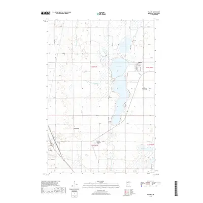
2019 Map of Villard
USGS Topo · Published 2019About this map
Villard sits at the junction of several county highways, serving as a focal point for the surrounding agricultural and lakeside landscape of Pope County. The area is defined by a chain of water bodies, including the large basins of Villard Lake and Amelia Lake, which are connected to a broader network of drainage and natural flows like the E Br Chippewa River. The human footprint is most visible through a dense grid of township and county roads, reflecting the region's long-established farming heritage and rural development.
Find a feature on this map
78 named features on this map. Tap any name to fly to it.
Don’t see what you’re looking for? This feature index may not catch every label — zoom into the map to look around manually.
Map Details
Editions of this 2019 Villard Map
This is the sole edition of this map. No revisions or reprints were ever made.
Other maps of this area

1953 · Saint Cloud
USGS Topo · 1:250,000

1957 · Saint Cloud
USGS Topo · 1:250,000

1958 · Saint Cloud
USGS Topo · 1:250,000

1965 · Westport
USGS Topo · 1:24,000

1965 · Sedan
USGS Topo · 1:24,000

1966 · Osakis
USGS Topo · 1:24,000

1966 · Lake Mary
USGS Topo · 1:24,000

1966 · Forada
USGS Topo · 1:24,000

1968 · Glenwood
USGS Topo · 1:24,000

1968 · Terrace
USGS Topo · 1:24,000