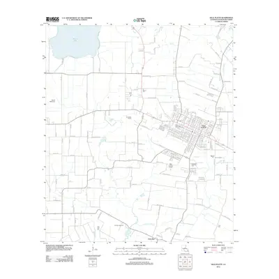
2012 Map of Ville Platte
USGS Topo · Published 2012About this map
Ville Platte serves as the primary hub of this Evangeline Parish landscape, where a dense network of local roads radiates from the town center into the surrounding rural prairies. The landscape is characterized by the transition from the residential streets of the parish seat to the agricultural and resource-rich lands of Prairie Mamou. To the south, the Point Blue Gas Field signifies the region's energy production, while the northern edge is defined by the large expanse of Millers Lake. The survey documents numerous community markers essential for genealogical research, including the Te Mamou Cem, Pine Point Cem, and Jules Cem. Educational and civic life is centered at Ville Platte High School and Evangeline Memorial Park, while transportation infrastructure like Sylvesters Airport and the winding Coulee Manuel provide a detailed look at how the local topography and economy were managed in the early 21st century.
Find a feature on this map
139 named features on this map. Tap any name to fly to it.
Don’t see what you’re looking for? This feature index may not catch every label — zoom into the map to look around manually.
Map Details
Editions of this 2012 Ville Platte Map
This is the sole edition of this map. No revisions or reprints were ever made.
Other maps of this area

1935 · Turkey Creek
USGS Topo · 1:62,500

1939 · Opelousas
USGS Topo · 1:62,500

1947 · Ville Platte
USGS Topo · 1:31,680

1947 · Redland
USGS Topo · 1:31,680

1947 · Chataignier
USGS Topo · 1:31,680

1948 · Bunkie
USGS Topo · 1:62,500

1949 · Turkey Creek
USGS Topo · 1:62,500

1952 · Lake Charles
USGS Topo · 1:250,000

1954 · Lake Charles
USGS Topo · 1:250,000

1956 · Opelousas
USGS Topo · 1:62,500