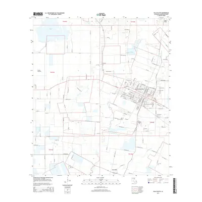
2015 Map of Ville Platte
USGS Topo · Published 2015About this map
Ville Platte serves as the focal point of this survey, surrounded by the agricultural expanses of Prairie Mammou and the winding course of Bayou Joe Marcel. The landscape is a patchwork of rural homesteads and family legacy, marked by several prominent burial grounds including Te Mamou Cem, Evangeline Memorial Park, and Jules Cem. The road network radiates from the town center towards smaller outlying communities like Point Blue, Tate Cove, and Te Mamou.
Find a feature on this map
149 named features on this map. Tap any name to fly to it.
Don’t see what you’re looking for? This feature index may not catch every label — zoom into the map to look around manually.
Map Details
Editions of this 2015 Ville Platte Map
This is the sole edition of this map. No revisions or reprints were ever made.
Other maps of this area

1935 · Turkey Creek
USGS Topo · 1:62,500

1939 · Opelousas
USGS Topo · 1:62,500

1947 · Ville Platte
USGS Topo · 1:31,680

1947 · Redland
USGS Topo · 1:31,680

1947 · Chataignier
USGS Topo · 1:31,680

1948 · Bunkie
USGS Topo · 1:62,500

1949 · Turkey Creek
USGS Topo · 1:62,500

1952 · Lake Charles
USGS Topo · 1:250,000

1954 · Lake Charles
USGS Topo · 1:250,000

1956 · Opelousas
USGS Topo · 1:62,500