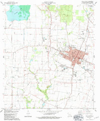
1983 Map of Ville Platte
USGS Topo · Published 1983About this map
Ville Platte serves as the focal point of this Cajun heartland survey, where the grid of the city meets the winding natural hydrology of Bayou des Cannes and Choctaw Bayou. The local economy is defined by a distinct mix of petroleum extraction at the Ville Platte Oil and Gas Field and expansive water management, evidenced by the vast Millers Lake in the northwest. Genealogy and local history are particularly well-represented through numerous burial grounds such as Te Mamou Cem, Pine Point Cem, and the St Johns Mem Garden (Cem). The Missouri Pacific Railroad cuts a diagonal path through the landscape, reinforcing the town's role as a regional hub. From the Courthouse at the center of town to the outlying settlement of Point Blue, the map documents a community deeply integrated with its prairie and bayou environment.
Find a feature on this map
50 named features on this map. Tap any name to fly to it.
Don’t see what you’re looking for? This feature index may not catch every label — zoom into the map to look around manually.
Map Details
Editions of this 1983 Ville Platte Map
This is the sole edition of this map. No revisions or reprints were ever made.
Other maps of this area

1935 · Turkey Creek
USGS Topo · 1:62,500

1939 · Opelousas
USGS Topo · 1:62,500

1947 · Ville Platte
USGS Topo · 1:31,680

1947 · Redland
USGS Topo · 1:31,680

1947 · Chataignier
USGS Topo · 1:31,680

1948 · Bunkie
USGS Topo · 1:62,500

1949 · Turkey Creek
USGS Topo · 1:62,500

1952 · Lake Charles
USGS Topo · 1:250,000

1954 · Lake Charles
USGS Topo · 1:250,000

1956 · Opelousas
USGS Topo · 1:62,500