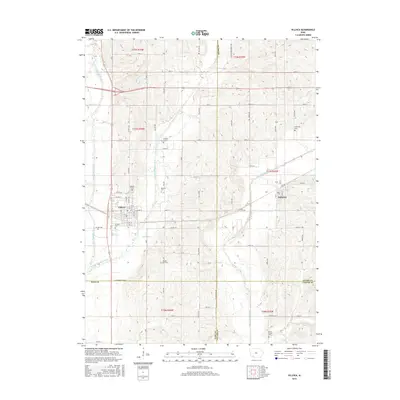
2015 Map of Villisca
USGS Topo · Published 2015About this map
The convergence of the West Nodaway River, Middle Nodaway River, and East Nodaway River defines the landscape of this portion of Montgomery County. This agricultural region is anchored by the town of Villisca, where the local street grid includes W High St and the curiously named Lover's Ln. To the east, the smaller settlement of Nodaway sits near the river's bend, illustrating the historic importance of water access for development in western Iowa.
Find a feature on this map
31 named features on this map. Tap any name to fly to it.
Don’t see what you’re looking for? This feature index may not catch every label — zoom into the map to look around manually.
Map Details
Editions of this 2015 Villisca Map
This is the sole edition of this map. No revisions or reprints were ever made.
Other maps of this area

1954 · Omaha
USGS Topo · 1:250,000

1955 · Nebraska City
USGS Topo · 1:250,000

1957 · Nebraska City
USGS Topo · 1:250,000

1957 · Omaha
USGS Topo · 1:250,000

1958 · Omaha
USGS Topo · 1:250,000

1958 · Nebraska City
USGS Topo · 1:250,000

1978 · Stanton
USGS Topo · 1:24,000

1978 · Wallin
USGS Topo · 1:24,000

1978 · Clarinda North
USGS Topo · 1:24,000

1980 · Guss
USGS Topo · 1:24,000