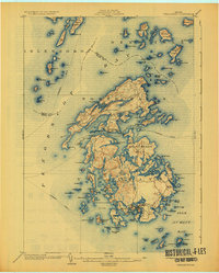
1904 Map of Vinalhaven
USGS Topo · Published 1925About this map
Vinalhaven Island and North Haven Island anchor this coastal Maine survey, revealing a landscape defined by intricate granite shorelines and a maritime economy. The map records the active Steamboat Route threading through Penobscot Bay and East Penobscot Bay, connecting isolated outposts like Stimpsons and North Haven. Significant landforms such as Calderwood Neck and the many inlets of Southern Harbor illustrate the complex geography of the Fox Islands. The map documents numerous smaller islands, from Seven Hundred Acre Island to the remote Butter Island, alongside critical navigational aids like Heron Neck Lt. guarding the entrance to Hurricane Sound. This survey captures the region's topography before mid-century changes, preserving the locations of family-named coves and inland waters like Fresh Pond and Folly Pond.
Find a feature on this map
144 named features on this map. Tap any name to fly to it.
Don’t see what you’re looking for? This feature index may not catch every label — zoom into the map to look around manually.
Map Details
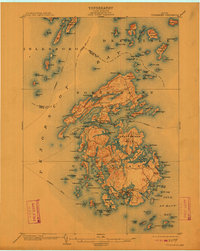
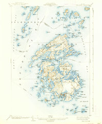
Editions of this 1904 Vinalhaven Map
4 editions found
Other maps of this area

1902 · Castine
USGS Topo · 1:62,500

1904 · Deer Isle
USGS Topo · 1:62,500

1904 · Castine
USGS Topo · 1:62,500

1904 · Bluehill
USGS Topo · 1:62,500

1904 · Vinalhaven
USGS Topo · 1:62,500

1904 · Tenants Harbor
USGS Topo · 1:62,500

1904 · Rockland
USGS Topo · 1:62,500

1905 · Penobscot Bay
USGS Topo · 1:125,000

1906 · Matinicus
USGS Topo · 1:62,500

1906 · Tennant Harbor
USGS Topo · 1:62,500