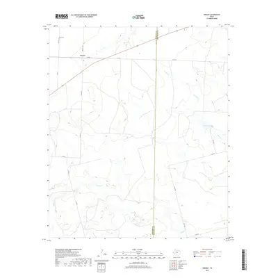
2019 Map of Vincent
USGS Topo · Published 2019About this map
The community of Vincent serves as a quiet center in this West Texas landscape, positioned near the intersection of Fm 846 and Ranch Rd 1205. For those tracing local history, the Vincent Cem north of the settlement provides a primary genealogical link to the area's residents. The terrain is defined by a network of drainage systems, including Morgan Cr and Hasting Cr, which move across the plains toward the Mitchell County line. Lake Gregory stands out as a significant water feature in this arid region, providing a contrast to the surrounding ranch land. The map also delineates the precise boundary between Howard and Mitchell Counties, illustrating how local governance is superimposed over the natural flow of Wildhorse Cr.
Find a feature on this map
20 named features on this map. Tap any name to fly to it.
Don’t see what you’re looking for? This feature index may not catch every label — zoom into the map to look around manually.
Map Details
Editions of this 2019 Vincent Map
This is the sole edition of this map. No revisions or reprints were ever made.
Other maps of this area

1942 · Big Spring North
USGS Topo · 1:62,500

1951 · Ira SW
USGS Topo · 1:24,000

1951 · Ira
USGS Topo · 1:24,000

1951 · Vincent
USGS Topo · 1:24,000

1951 · Iatan
USGS Topo · 1:24,000

1952 · Iatan
USGS Topo · 1:24,000

1952 · Cuthbert
USGS Topo · 1:24,000

1952 · Westbrook
USGS Topo · 1:24,000

1954 · Big Spring
USGS Topo · 1:250,000

1954 · Big Spring North NE
USGS Topo · 1:24,000