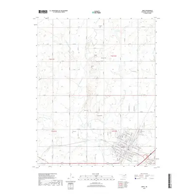
2019 Map of Vinita
USGS Topo · Published 2019About this map
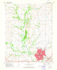
Vinita serves as the focal point of this Craig County landscape, situated where the terrain begins to rise toward prominent elevations like Donnelly Hill and Pheasant Hill. The city's residential and commercial grid is captured in detail, including its southern expansion along W Dwain Willis Ave and eastern reach toward Fairview Cem. Beyond the city limits, the landscape transitions into a network of section-line roads and family-named cemeteries that speak to the area's rural heritage. Numerous burial grounds, including Bluejacket Cem, Thomas Cem, and Keys Cem, are scattered across the township, often situated near the winding courses of Big Cabin Creek and its many tributaries like Pecan Cr and Pawpaw Cr. The map documents a well-connected agricultural region where creek valleys and ridges have influenced the placement of longstanding homesteads and community landmarks.
Find a feature on this map
99 named features on this map. Tap any name to fly to it.
Don’t see what you’re looking for? This feature index may not catch every label — zoom into the map to look around manually.
Map Details
Editions of this 2019 Vinita Map
This is the sole edition of this map. No revisions or reprints were ever made.
Other maps of this area

1901 · Vinita
USGS Topo · 1:125,000

1913 · Vinita
USGS Topo · 1:125,000

1954 · Tulsa
USGS Topo · 1:250,000

1958 · Tulsa
USGS Topo · 1:250,000

1963 · Tulsa
USGS Topo · 1:250,000

1970 · White Oak
USGS Topo · 1:24,000
1971 · Pyramid Corners
USGS Topo · 1:24,000
1971 · Big Cabin
USGS Topo · 1:24,000
1971 · Ketchum
USGS Topo · 1:24,000
1971 · Vinita
USGS Topo · 1:24,000