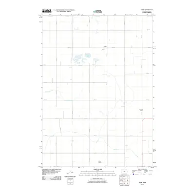
2010 Map of Vinje
USGS Topo · Published 2010About this map
Vinje sits at the northern edge of Winnebago County, where the regular grid of Iowa country roads meets the Minnesota border. This agricultural landscape is defined by the headwaters of Little Buffalo Creek and the winding course of Pike Run, which drain the surrounding prairie lands. The area around Harmon Lake reveals a glaciated terrain of small basins and wetlands that have resisted the strict rectilinear geometry of the local section lines.
Find a feature on this map
25 named features on this map. Tap any name to fly to it.
Don’t see what you’re looking for? This feature index may not catch every label — zoom into the map to look around manually.
Map Details
Editions of this 2010 Vinje Map
This is the sole edition of this map. No revisions or reprints were ever made.
Other maps of this area

1954 · Mason City
USGS Topo · 1:250,000

1955 · Bricelyn
USGS Topo · 1:62,500

1955 · Wells
USGS Topo · 1:62,500

1957 · Mason City
USGS Topo · 1:250,000

1958 · Mason City
USGS Topo · 1:250,000

1972 · Forest City
USGS Topo · 1:24,000

1972 · Buffalo Center NE
USGS Topo · 1:24,000

1972 · Pilot Knob
USGS Topo · 1:24,000

1972 · Vinje
USGS Topo · 1:24,000
1972 · Thompson
USGS Topo · 1:24,000