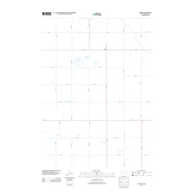
2013 Map of Vinje
USGS Topo · Published 2013About this map
Vinje sits at the intersection of 490th St and 150th Ave, serving as the primary anchor for this agrarian landscape on the border of Iowa and Minnesota. The terrain is defined by a grid of rural roads and scattered water bodies, most notably Harmon Lake in the northwest. This 2013 survey illustrates the modern agricultural footprint of Winnebago County, where the natural drainage patterns of Little Buffalo Creek and the meandering Pike Run dictate the placement of local thoroughfares like 440th St and 120th Ave. The map reflects a highly organized rural infrastructure, showing how the section-line roads frame the remaining natural pockets of the Upper Midwest prairie-pothole region.
Find a feature on this map
20 named features on this map. Tap any name to fly to it.
Don’t see what you’re looking for? This feature index may not catch every label — zoom into the map to look around manually.
Map Details
Editions of this 2013 Vinje Map
This is the sole edition of this map. No revisions or reprints were ever made.
Other maps of this area

1954 · Mason City
USGS Topo · 1:250,000

1955 · Bricelyn
USGS Topo · 1:62,500

1955 · Wells
USGS Topo · 1:62,500

1957 · Mason City
USGS Topo · 1:250,000

1958 · Mason City
USGS Topo · 1:250,000

1972 · Forest City
USGS Topo · 1:24,000

1972 · Buffalo Center NE
USGS Topo · 1:24,000

1972 · Pilot Knob
USGS Topo · 1:24,000

1972 · Vinje
USGS Topo · 1:24,000
1972 · Thompson
USGS Topo · 1:24,000