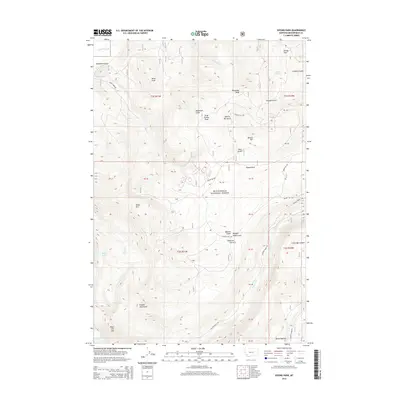
2014 Map of Vipond Park
USGS Topo · Published 2014About this map
Vipond Park and the surrounding heights of the Pioneer Mountains define this high-elevation landscape within the Beaverhead National Forest. This 2014 survey reveals a terrain shaped by deep drainage systems and prominent summits, including Ponsonby Peak and Gray Jockey Peak. The map highlights the extensive network of canyons and gulches, such as Echo Gulch and Queens Gulch, which historically served as corridors through these mountains.
Find a feature on this map
49 named features on this map. Tap any name to fly to it.
Don’t see what you’re looking for? This feature index may not catch every label — zoom into the map to look around manually.
Map Details
Editions of this 2014 Vipond Park Map
This is the sole edition of this map. No revisions or reprints were ever made.
Other maps of this area

1893 · Dillon
USGS Topo · 1:250,000

1955 · Dillon
USGS Topo · 1:250,000

1957 · Dillon
USGS Topo · 1:250,000

1958 · Dillon
USGS Topo · 1:250,000

1958 · Vipond Park
USGS Topo · 1:62,500

1961 · Dewey
USGS Topo · 1:24,000

1961 · Wise River
USGS Topo · 1:24,000

1962 · Dillon
USGS Topo · 1:250,000
1962 · Dickie Hills
USGS Topo · 1:24,000

1965 · Dillon
USGS Topo · 1:250,000