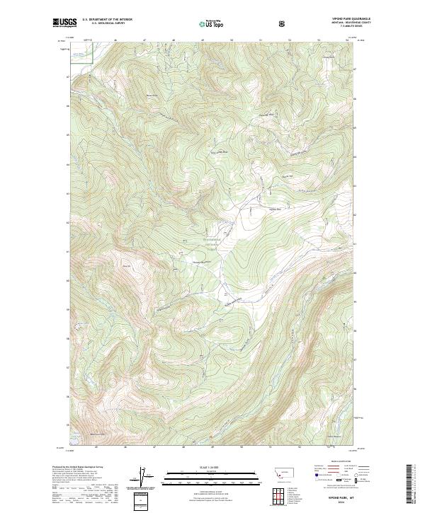
2024 Map of Vipond Park
USGS Topo · Published 2024About this map
The Pioneer Mountains dominate this high-elevation landscape within the Beaverhead National Forest, defined by a network of steep gulches and isolated peaks. Waterways such as the Wise River and Canyon Creek carve through the terrain, which is punctuated by prominent landmarks like Gray Jockey Peak and Ponsonby Peak. The settlement patterns here are focused on high mountain parks and meadows, notably Vipond Park and Knoby Park, which provided rare level ground in the backcountry. A history of extraction and mountain transit is evident in the naming of Quartz Hill and the numerous named gulches like Mammoth Gulch and Echo Gulch. These features, alongside family or locally-named spots like Yanks Pasture, reflect a landscape utilized for its mineral potential and summer grazing. High-altitude lakes, including Bobs Lake and Black Lion Lake near Black Lion Mtn, indicate the glacial origins of these upper reaches of Beaverhead County.
Find a feature on this map
46 named features on this map. Tap any name to fly to it.
Don’t see what you’re looking for? This feature index may not catch every label — zoom into the map to look around manually.
Map Details
Editions of this 2024 Vipond Park Map
This is the sole edition of this map. No revisions or reprints were ever made.
Other maps of this area

1893 · Dillon
USGS Topo · 1:250,000

1955 · Dillon
USGS Topo · 1:250,000

1957 · Dillon
USGS Topo · 1:250,000

1958 · Dillon
USGS Topo · 1:250,000

1958 · Vipond Park
USGS Topo · 1:62,500

1961 · Dewey
USGS Topo · 1:24,000

1961 · Wise River
USGS Topo · 1:24,000

1962 · Dillon
USGS Topo · 1:250,000
1962 · Dickie Hills
USGS Topo · 1:24,000

1965 · Dillon
USGS Topo · 1:250,000