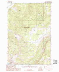
1988 Map of Vipond Park
USGS Topo · Published 1988About this map
Beaverhead National Forest defines this high-altitude landscape, where the rugged extraction history of southwest Montana is etched into the terrain. The 1988 survey details an extensive network of mining operations clustered around Quartz Hill and Gray Jockey Peak, including the Monte Cristo Mine, Daisy Vein Mine, and Old Faithful Mine. These sites, along with numerous unnamed adits and mine shafts, point to a period of intense silver and base metal prospecting.
Find a feature on this map
47 named features on this map. Tap any name to fly to it.
Don’t see what you’re looking for? This feature index may not catch every label — zoom into the map to look around manually.
Map Details
Editions of this 1988 Vipond Park Map
This is the sole edition of this map. No revisions or reprints were ever made.
Other maps of this area

1893 · Dillon
USGS Topo · 1:250,000

1955 · Dillon
USGS Topo · 1:250,000

1957 · Dillon
USGS Topo · 1:250,000

1958 · Dillon
USGS Topo · 1:250,000

1958 · Vipond Park
USGS Topo · 1:62,500

1961 · Dewey
USGS Topo · 1:24,000

1961 · Wise River
USGS Topo · 1:24,000

1962 · Dillon
USGS Topo · 1:250,000
1962 · Dickie Hills
USGS Topo · 1:24,000

1965 · Dillon
USGS Topo · 1:250,000