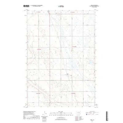
2017 Map of Virgil
USGS Topo · Published 2017About this map
Virgil serves as the central settlement in this portion of Beadle County, characterized by the expansive prairie landscape of the James River Valley. The area is defined by a grid of agricultural section lines, including Co Rd 20 and 389th Ave, which connect the town to surrounding homesteads and regional markets. Water management and drainage are prominent features of the terrain, as seen in the winding course of Cain Creek and the marshy depression of Norwegian Slough in the northwest. For those researching local family history, the Virgil Cem located just southeast of the main townsite provides a vital genealogical link to the early families who settled this Beadle County township during the late nineteenth and early twentieth centuries.
Find a feature on this map
28 named features on this map. Tap any name to fly to it.
Don’t see what you’re looking for? This feature index may not catch every label — zoom into the map to look around manually.
Map Details
Editions of this 2017 Virgil Map
This is the sole edition of this map. No revisions or reprints were ever made.
Other maps of this area

1898 · Huron
USGS Topo · 1:125,000

1950 · Wessington NE
USGS Topo · 1:24,000

1951 · Wessington SE
USGS Topo · 1:24,000

1953 · Huron
USGS Topo · 1:250,000

1954 · Huron
USGS Topo · 1:250,000
1973 · Wolsey
USGS Topo · 1:24,000

1973 · Alpena
USGS Topo · 1:24,000

1973 · Wessington Springs NE
USGS Topo · 1:24,000
1973 · Broadland
USGS Topo · 1:24,000
1973 · Virgil
USGS Topo · 1:24,000