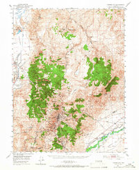
1950 Map of Virginia City
USGS Topo · Published 1966About this map
The Comstock Lode’s enduring legacy is etched across this landscape, centered on the high-elevation settlements of Virginia City and Gold Hill. This 1950 field-checked survey reveals an intricate network of mining claims and infrastructure along the Virginia Range, including legendary names like Yellow Jacket, Chollar, and Potosi. The massive engineering feat of the Sutro Tunnel is traced from its eastern portal near Sutro (Site) westward toward the heart of the mining district beneath Mt Davidson.
Find a feature on this map
111 named features on this map. Tap any name to fly to it.
Don’t see what you’re looking for? This feature index may not catch every label — zoom into the map to look around manually.
Map Details
Editions of this 1950 Virginia City Map
3 editions found
Other maps of this area

1890 · Wadsworth
USGS Topo · 1:125,000

1891 · Carson
USGS Topo · 1:125,000

1891 · Wabuska
USGS Topo · 1:125,000

1891 · Reno
USGS Topo · 1:125,000

1892 · Wadsworth
USGS Topo · 1:125,000

1893 · Carson
USGS Topo · 1:125,000

1893 · Reno
USGS Topo · 1:125,000

1894 · Wadsworth
USGS Topo · 1:125,000

1894 · Wabuska
USGS Topo · 1:125,000

1950 · Virginia City
USGS Topo · 1:62,500