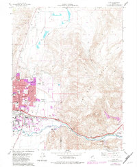
1975 Map of Vista
USGS Topo · Published 1983About this map
The city of Sparks expands eastward into the Meadows during this mid-1970s revision, showing the transition from agricultural valley to suburban growth. While the University of Nevada Farm and Spanish Springs Ranch represent the area’s ranching heritage, new developments like Reed High Sch and multiple trailer parks indicate the rapid residential shift. The Southern Pacific railroad remains a critical corridor, paralleling the Truckee River through the canyon between the Pah Rah Range and the Virginia Range. Industrial activity is evident along the river at Vista and Mustang, where gravel pits and borrow pits dot the landscape. This sheet effectively documents the loss of open valley floor to city infrastructure, including the Radio Towers (KOH) and the Mc Carran Blvd extension, just before the full suburban build-out of the late 20th century.
Find a feature on this map
53 named features on this map. Tap any name to fly to it.
Don’t see what you’re looking for? This feature index may not catch every label — zoom into the map to look around manually.
Map Details
Editions of this 1975 Vista Map
4 editions found
Other maps of this area

1891 · Carson
USGS Topo · 1:125,000

1891 · Reno
USGS Topo · 1:125,000

1893 · Carson
USGS Topo · 1:125,000

1893 · Reno
USGS Topo · 1:125,000

1950 · Virginia City
USGS Topo · 1:62,500

1950 · Mt. Rose
USGS Topo · 1:62,500

1950 · Reno
USGS Topo · 1:62,500

1951 · Reno
USGS Topo · 1:62,500

1952 · Mt. Rose
USGS Topo · 1:62,500

1952 · Virginia City
USGS Topo · 1:62,500