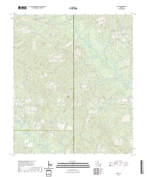
2024 Map of Vixen
USGS Topo · Published 2024About this map
The settlement of Vixen serves as a central point in this rural landscape where the borders of Jackson, Caldwell, and Winn Parishes converge. This modern survey reveals a region defined by its dense network of waterways, including Bull Creek, Brushy Creek, and Beaucoup Creek, which carve through the terrain. The presence of several historic burial sites, such as Asberry Cem, Palestine Cem, and Hickory Springs Cem, suggests long-standing family ties and community nodes in an area dominated by timberlands and winding parish roads.
Find a feature on this map
68 named features on this map. Tap any name to fly to it.
Don’t see what you’re looking for? This feature index may not catch every label — zoom into the map to look around manually.
Map Details
Editions of this 2024 Vixen Map
This is the sole edition of this map. No revisions or reprints were ever made.
Other maps of this area

1940 · Monroe
USGS Topo · 1:62,500

1940 · Columbia
USGS Topo · 1:62,500

1953 · Chatham
USGS Topo · 1:62,500

1954 · Sikes
USGS Topo · 1:62,500

1955 · Shreveport
USGS Topo · 1:250,000

1956 · Shreveport
USGS Topo · 1:250,000

1957 · Columbia
USGS Topo · 1:62,500

1957 · Monroe South
USGS Topo · 1:62,500

1982 · Chatham
USGS Topo · 1:24,000

1982 · Chatham SE
USGS Topo · 1:24,000