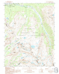
1994 Map of Vogelsang Peak
USGS Topo · Published 1995About this map
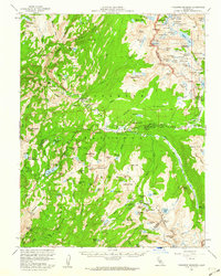
Tuolumne Meadows serves as the gateway to this high-elevation wilderness in the mid-1990s, anchored by the Tuolumne Meadows Post Office and a central Visitor Center. This area of Yosemite is a critical junction for long-distance hikers, where the Pacific Crest National Scenic Trail and the John Muir Trail (Scenic) converge among the granite peaks. The landscape is defined by the sharp rise of the Cathedral Range, which separates the drainage of the Lyell Fork and the Dana Fork of the Tuolumne River. Further south, the Vogelsang High Sierra Camp provides a remote outpost near Vogelsang Lake and Vogelsang Pass. The presence of the Maclure Glacier beneath the high peaks highlights the alpine nature of this territory, while numerous high-basin lakes like Ireland Lake and Evelyn Lake dot the glaciated terrain.
Find a feature on this map
62 named features on this map. Tap any name to fly to it.
Don’t see what you’re looking for? This feature index may not catch every label — zoom into the map to look around manually.
Map Details
Editions of this 1994 Vogelsang Peak Map
2 editions found

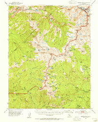
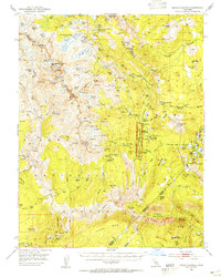
Other maps of this area

1901 · Mt. Lyell
USGS Topo · 1:125,000

1947 · Mariposa
USGS Topo · 1:250,000

1948 · Mariposa
USGS Topo · 1:250,000
1953 · Merced Peak
USGS Topo · 1:62,500
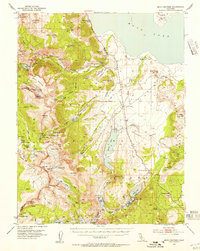
1953 · Mono Craters
USGS Topo · 1:62,500
1953 · Devils Postpile
USGS Topo · 1:62,500
1956 · Tuolumne Meadows
USGS Topo · 1:62,500

1957 · Mariposa
USGS Topo · 1:250,000

1963 · Mariposa
USGS Topo · 1:250,000
1976 · Yosemite Valley
USGS Topo · 1:100,000