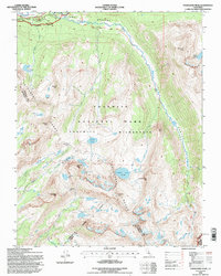
1994 Map of Vogelsang Peak
USGS Topo · Published 1997About this map
Vogelsang High Sierra Camp serves as a central hub for high-altitude exploration within the Yosemite Wilderness, situated amidst the high peaks of the Cathedral Range. This mid-1990s revision by the U.S. Forest Service documents a landscape defined by glacial activity and drainage patterns, where the Lyell Fork Tuolumne River meanders through the broad Lyell Meadows. The map captures the intersection of major high-country routes, including the John Muir Trail and the Pacific Crest National Scenic Trail, as they navigate complex terrain around Vogelsang Pass. To the north, the Tuolumne Meadows Post Office and Visitor Center near Tioga Road mark the gateway to this alpine region. Notable water features such as the Maclure Glacier and numerous high-elevation basins like Ireland Lake and Evelyn Lake highlight the area's hydrology at the headwaters of the Tuolumne.
Find a feature on this map
53 named features on this map. Tap any name to fly to it.
Don’t see what you’re looking for? This feature index may not catch every label — zoom into the map to look around manually.
Map Details
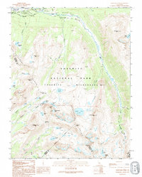
Editions of this 1994 Vogelsang Peak Map
2 editions found
Other maps of this area

1901 · Mt. Lyell
USGS Topo · 1:125,000

1947 · Mariposa
USGS Topo · 1:250,000

1948 · Mariposa
USGS Topo · 1:250,000

1953 · Merced Peak
USGS Topo · 1:62,500

1953 · Mono Craters
USGS Topo · 1:62,500

1953 · Devils Postpile
USGS Topo · 1:62,500

1956 · Tuolumne Meadows
USGS Topo · 1:62,500

1957 · Mariposa
USGS Topo · 1:250,000

1963 · Mariposa
USGS Topo · 1:250,000
1976 · Yosemite Valley
USGS Topo · 1:100,000