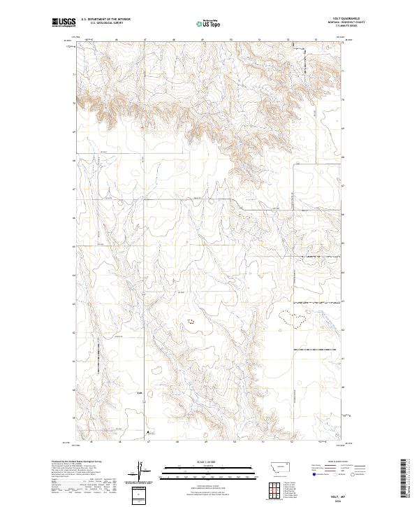
2024 Map of Volt
USGS Topo · Published 2024About this map
Volt stands as a small community node in the northern Missouri River basin, centered in a landscape of drainage breaks and ranching country. The settlement's history is anchored by the Volt Cem located just to the south, while the winding course of Tule Creek and its tributary, North Fork Tule Creek, define the area's natural geography. The map reveals a systematic grid of county roads, including Lustre Rd and Powder River Rd, which facilitate movement through these High Plains townships. A notably named Wall St and several numbered routes like Rd 1077 and Rd 1078 illustrate the connectivity required for rural life in Roosevelt County. This detailed look at the Public Land Survey System shows the interface between long-established property lines and the shifting hydrology of the local coulees.
Find a feature on this map
22 named features on this map. Tap any name to fly to it.
Don’t see what you’re looking for? This feature index may not catch every label — zoom into the map to look around manually.
Map Details
Editions of this 2024 Volt Map
This is the sole edition of this map. No revisions or reprints were ever made.
Other maps of this area

1910 · Todd Lakes
USGS Topo · 1:62,500

1915 · Tule Valley
USGS Topo · 1:62,500

1915 · Todd Lakes
USGS Topo · 1:62,500

1954 · Wolf Point
USGS Topo · 1:250,000

1958 · Wolf Point
USGS Topo · 1:250,000

1973 · Peerless 4 SE
USGS Topo · 1:24,000

1973 · Peerless 4 SW
USGS Topo · 1:24,000

1973 · Poplar Coulee
USGS Topo · 1:24,000
1983 · Todd Lakes NE
USGS Topo · 1:24,000
1983 · Tule Valley East
USGS Topo · 1:24,000