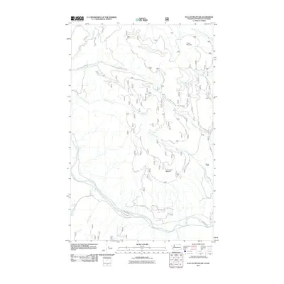
2011 Map of Vulcan Mountain
USGS Topo · Published 2011About this map
Colville National Forest dominates this landscape along the international boundary, where the terrain rises toward the heights of Vulcan Mountain and Little Vulcan Mountain. The northern edge of the map is defined by the Canadian border, indicated by the winding path of Border Rd. High-altitude features like the Vulcan Lookout suggest the area's role in forest management and wildfire monitoring.
Find a feature on this map
44 named features on this map. Tap any name to fly to it.
Don’t see what you’re looking for? This feature index may not catch every label — zoom into the map to look around manually.
Map Details
Editions of this 2011 Vulcan Mountain Map
This is the sole edition of this map. No revisions or reprints were ever made.
Other maps of this area

1904 · Republic
USGS Topo · 1:125,000

1948 · Curlew
USGS Topo · 1:62,500

1951 · Curlew
USGS Topo · 1:62,500

1951 · Bodie Mountain
USGS Topo · 1:62,500

1954 · Okanogan
USGS Topo · 1:250,000

1958 · Okanogan
USGS Topo · 1:250,000

1958 · Bodie Mtn
USGS Topo · 1:62,500

1984 · Republic
USGS Topo · 1:100,000
1988 · Curlew
USGS Topo · 1:24,000
1988 · Vulcan Mountain
USGS Topo · 1:24,000