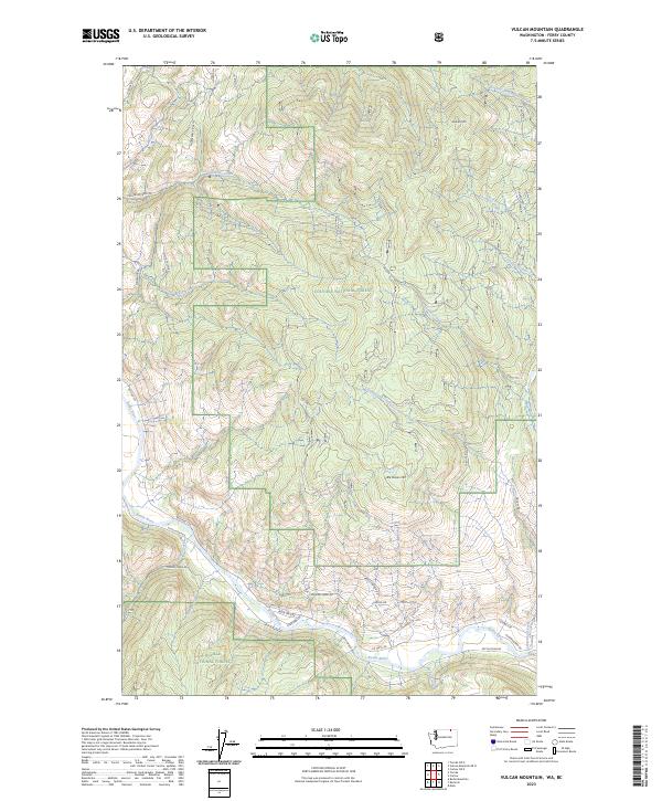
2023 Map of Vulcan Mountain
USGS Topo · Published 2023About this map
The Kettle River winds through the lower portion of this terrain, marking the southern boundary of a landscape dominated by the high elevations of Vulcan Mtn and Little Vulcan Mtn. Set within the Colville National Forest in Ferry County, the area is defined by a dense network of drainages including Catherine Creek, Goosmus Creek, and Tenas Mary Creek. These watercourses carve through the mountainous topography, which is accessed by a system of rural roads and forest routes like Catherine Creek Rd and Tonata Creek Rd. The proximity to the international border is evidenced by Border Rd at the northern edge, reflecting the remote character of this timbered region. Local development is concentrated primarily along the river corridor, where Co Hwy 530 and Kettle River Rd follow the valley floor past named residential spurs like Riverview Ln and Bent Birch Way.
Find a feature on this map
38 named features on this map. Tap any name to fly to it.
Don’t see what you’re looking for? This feature index may not catch every label — zoom into the map to look around manually.
Map Details
Editions of this 2023 Vulcan Mountain Map
This is the sole edition of this map. No revisions or reprints were ever made.
Other maps of this area

1904 · Republic
USGS Topo · 1:125,000

1948 · Curlew
USGS Topo · 1:62,500

1951 · Curlew
USGS Topo · 1:62,500

1951 · Bodie Mountain
USGS Topo · 1:62,500

1954 · Okanogan
USGS Topo · 1:250,000

1958 · Okanogan
USGS Topo · 1:250,000

1958 · Bodie Mtn
USGS Topo · 1:62,500

1984 · Republic
USGS Topo · 1:100,000
1988 · Curlew
USGS Topo · 1:24,000
1988 · Vulcan Mountain
USGS Topo · 1:24,000