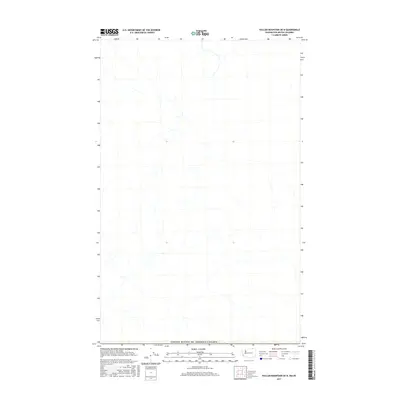
2017 Map of Vulcan Mountain OE N
USGS Topo · Published 2017About this map
The international border at the United States of America/Canada boundary anchors this topographic study of the northernmost edge of Ferry County, Washington, and the southern reaches of British Columbia. This sparsely labeled quadrangle focuses on the intricate hydrography and terrain elevations of the mountain region north of Curlew. The map documents the physical geography of the high country, recording the drainage patterns and relief that define this transborder landscape. Researchers will find it primarily useful for its detailed mapping of natural features and the precise delineation of the international boundary line in a relatively remote section of the Pacific Northwest.
Find a feature on this map
1 named feature on this map. Tap any name to fly to it.
Don’t see what you’re looking for? This feature index may not catch every label — zoom into the map to look around manually.
Map Details
Editions of this 2017 Vulcan Mountain OE N Map
This is the sole edition of this map. No revisions or reprints were ever made.
Other maps of this area

1904 · Republic
USGS Topo · 1:125,000

1948 · Curlew
USGS Topo · 1:62,500

1951 · Curlew
USGS Topo · 1:62,500

1951 · Bodie Mountain
USGS Topo · 1:62,500

1954 · Okanogan
USGS Topo · 1:250,000

1958 · Okanogan
USGS Topo · 1:250,000

1958 · Bodie Mtn
USGS Topo · 1:62,500

1984 · Republic
USGS Topo · 1:100,000
1988 · Curlew
USGS Topo · 1:24,000
1988 · Vulcan Mountain
USGS Topo · 1:24,000