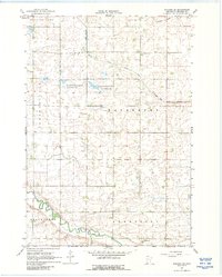
1967 Map of Wabasso SE
USGS Topo · Published 1988About this map
Sleepy Eye Creek winds through a landscape of organized townships and conservation lands in this late 1960s study of Redwood County. The map details a transition between agricultural drainage, marked by the extensive Judicial Ditch No 36, and preserved natural spaces like the Waterbury State Wildlife Management Area and Mammenga State Wildlife Management Area. These areas indicate a localized effort to balance intensive farming with habitat protection near the prairie wetlands. In the north, St Matthews Cem stands near a small Townhall, serving as a focal point for the rural community. To the south, the terrain descends toward the Cottonwood River, joined by Pell Creek, where the presence of multiple Gravel Pits reflects the area's geological utility for local infrastructure.
Find a feature on this map
18 named features on this map. Tap any name to fly to it.
Don’t see what you’re looking for? This feature index may not catch every label — zoom into the map to look around manually.
Map Details
Editions of this 1967 Wabasso SE Map
2 editions found
Other maps of this area

1953 · New Ulm
USGS Topo · 1:250,000

1957 · New Ulm
USGS Topo · 1:250,000

1958 · New Ulm
USGS Topo · 1:250,000

1967 · New Ulm
USGS Topo · 1:250,000

1967 · Wanda
USGS Topo · 1:24,000

1967 · Sanborn
USGS Topo · 1:24,000

1967 · Wabasso SE
USGS Topo · 1:24,000

1967 · Wabasso
USGS Topo · 1:24,000

1967 · Walnut Grove
USGS Topo · 1:24,000

1967 · Rowena
USGS Topo · 1:24,000