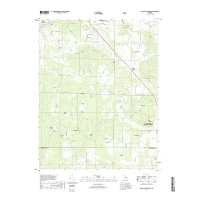
2017 Map of Wachita Mountain
USGS Topo · Published 2017About this map
The Saint Francois Mountains dominate this 2017 survey area, where the rugged terrain of southeastern Missouri meets the agricultural valleys near Farmington. Significant elevation changes are marked by peaks like Knob Lick Mtn and Wachita Mountain, while the Saint Francis River winds through the central corridor. Historical burial sites are well-preserved in the record, including the Doe Run Memorial Cem near the settlement of Doe Run and the O'Bannon Cem further south.
Find a feature on this map
98 named features on this map. Tap any name to fly to it.
Don’t see what you’re looking for? This feature index may not catch every label — zoom into the map to look around manually.
Map Details
Editions of this 2017 Wachita Mountain Map
This is the sole edition of this map. No revisions or reprints were ever made.
Other maps of this area

1904 · Farmington
USGS Topo · 1:62,500

1905 · Bonneterre
USGS Topo · 1:62,500

1906 · Farmington
USGS Topo · 1:62,500

1937 · Ironton
USGS Topo · 1:48,000

1939 · Fredericktown
USGS Topo · 1:48,000

1945 · Ironton
USGS Topo · 1:62,500

1946 · Ironton
USGS Topo · 1:62,500

1947 · Fredericktown
USGS Topo · 1:62,500

1949 · Rolla
USGS Topo · 1:250,000

1950 · Fredericktown
USGS Topo · 1:62,500