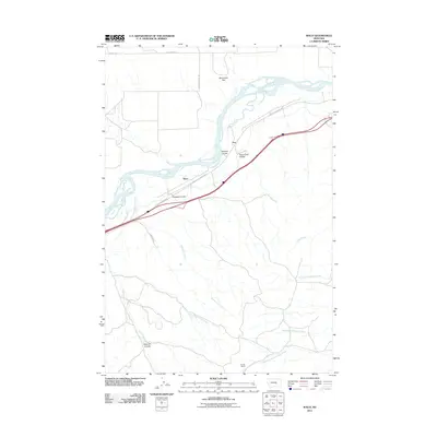
2011 Map of Waco
USGS Topo · Published 2011About this map
The Yellowstone River carves a broad valley through this portion of Yellowstone County, defining the agricultural and transit corridor of the region. On the river's northern bank, the expansive Sevenmile Flat stretches toward the horizon, while the southern banks are marked by a series of dramatic drainages including Witham Coulee, Thurmond Coulee, and Bergum Coulee.
Find a feature on this map
21 named features on this map. Tap any name to fly to it.
Don’t see what you’re looking for? This feature index may not catch every label — zoom into the map to look around manually.
Map Details
Editions of this 2011 Waco Map
This is the sole edition of this map. No revisions or reprints were ever made.
Other maps of this area

1894 · Fort Custer
USGS Topo · 1:125,000

1954 · Hardin
USGS Topo · 1:250,000

1954 · Forsyth
USGS Topo · 1:250,000

1957 · Hardin
USGS Topo · 1:250,000

1957 · Forsyth
USGS Topo · 1:250,000

1958 · Forsyth
USGS Topo · 1:250,000

1958 · Hardin
USGS Topo · 1:250,000

1960 · Foster
USGS Topo · 1:24,000

1960 · Coal Bank Creek
USGS Topo · 1:24,000

1960 · Custer
USGS Topo · 1:24,000