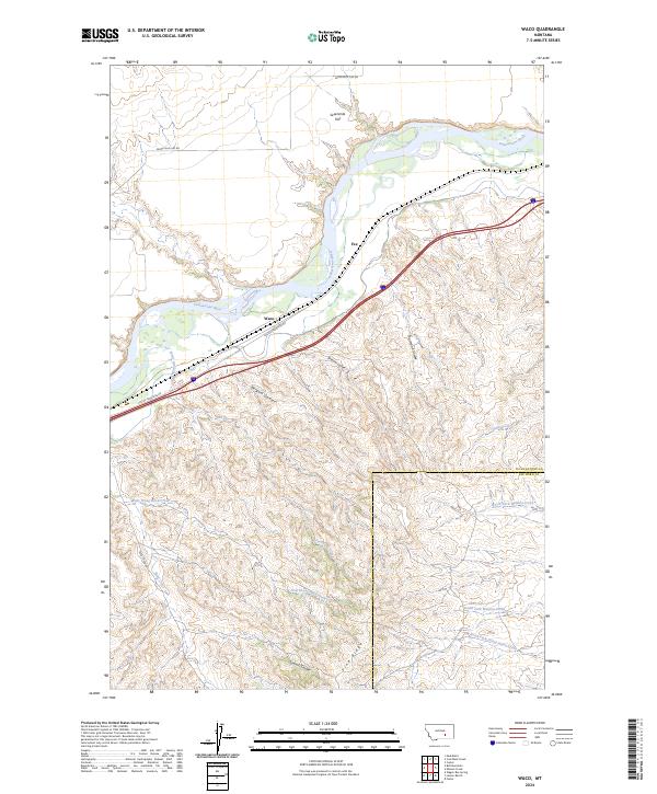
2024 Map of Waco
USGS Topo · Published 2024About this map
The Yellowstone River cuts through this landscape, defining the northern border of a region shaped by coulees and high flats at the boundary of Yellowstone and Big Horn counties. The settlement of Waco sits along the river's southern bank, positioned near the Custer Frontage Rd and a corridor of transportation that follows the natural grade of the valley. To the north, the terrain levels out at Sevenmile Flat, while the southern reaches of the map climb toward Pine Ridge. This area is heavily dissected by drainage systems, including Automatic Creek, Bergum Coulee, and the headwaters of North Fork Mission Creek, illustrating a classic prairie-and-break topography where water has carved deep paths through the high plains.
Find a feature on this map
24 named features on this map. Tap any name to fly to it.
Don’t see what you’re looking for? This feature index may not catch every label — zoom into the map to look around manually.
Map Details
Editions of this 2024 Waco Map
This is the sole edition of this map. No revisions or reprints were ever made.
Other maps of this area

1894 · Fort Custer
USGS Topo · 1:125,000

1954 · Hardin
USGS Topo · 1:250,000

1954 · Forsyth
USGS Topo · 1:250,000

1957 · Hardin
USGS Topo · 1:250,000

1957 · Forsyth
USGS Topo · 1:250,000

1958 · Forsyth
USGS Topo · 1:250,000

1958 · Hardin
USGS Topo · 1:250,000

1960 · Foster
USGS Topo · 1:24,000

1960 · Coal Bank Creek
USGS Topo · 1:24,000

1960 · Custer
USGS Topo · 1:24,000