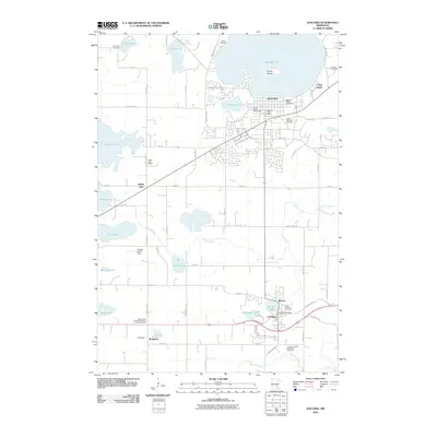
2010 Map of Waconia
USGS Topo · Published 2010About this map
Waconia sits prominently on the southern shore of Lake Waconia, where the distinctive Coney Island terrain rises from the water. This 2010 survey illustrates the growth of several Carver County communities, showing the residential expansion of Waconia alongside the smaller settlements of Benton, Cologne, and Bongards to the south. The area is defined by its glacial hydrology, with numerous smaller basins like Rutz Lake, Burandt Lake, and Hydes Lake dotting the landscape between Carver Creek and Bevens Creek. Local history and genealogy are well-represented by a high density of religious and civic landmarks, including the Hydes Lake School and several denominational burial grounds such as Saint Josephs Cemetery and the Cologne United Methodist Cemetery. The presence of the Carver County Fairgrounds and the Empire Farm Strip highlights the blend of municipal development and the region's enduring agricultural roots.
Find a feature on this map
75 named features on this map. Tap any name to fly to it.
Don’t see what you’re looking for? This feature index may not catch every label — zoom into the map to look around manually.
Map Details
Editions of this 2010 Waconia Map
This is the sole edition of this map. No revisions or reprints were ever made.
Other maps of this area

1905 · Minnetonka
USGS Topo · 1:62,500

1907 · Minnetonka
USGS Topo · 1:62,500

1953 · Saint Paul
USGS Topo · 1:250,000

1957 · Belle Plaine
USGS Topo · 1:62,500

1957 · Waconia
USGS Topo · 1:62,500

1957 · New Prague
USGS Topo · 1:62,500

1958 · Victoria
USGS Topo · 1:24,000

1958 · Mound
USGS Topo · 1:24,000

1958 · Lake Minnetonka
USGS Topo · 1:62,500

1959 · Saint Paul
USGS Topo · 1:250,000