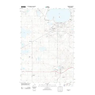
2013 Map of Waconia
USGS Topo · Published 2013About this map
Lake Waconia and its prominent Coney Island anchor this Carver County landscape, illustrating a region where recreational waters and agricultural traditions intersect. The city of Waconia is shown in detail, with its grid extending toward Burandt Lake and several historical burial grounds, including the Waconia Public Cem and Saint Josephs Cem. Further south, the map documents the smaller settlements of Benton, Cologne, and Bongards, which are connected by a network of state roads like MN-5 and MN-284.
Find a feature on this map
89 named features on this map. Tap any name to fly to it.
Don’t see what you’re looking for? This feature index may not catch every label — zoom into the map to look around manually.
Map Details
Editions of this 2013 Waconia Map
This is the sole edition of this map. No revisions or reprints were ever made.
Other maps of this area

1905 · Minnetonka
USGS Topo · 1:62,500

1907 · Minnetonka
USGS Topo · 1:62,500

1953 · Saint Paul
USGS Topo · 1:250,000

1957 · Belle Plaine
USGS Topo · 1:62,500

1957 · Waconia
USGS Topo · 1:62,500

1957 · New Prague
USGS Topo · 1:62,500

1958 · Victoria
USGS Topo · 1:24,000

1958 · Mound
USGS Topo · 1:24,000

1958 · Lake Minnetonka
USGS Topo · 1:62,500

1959 · Saint Paul
USGS Topo · 1:250,000