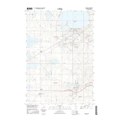
2016 Map of Waconia
USGS Topo · Published 2016About this map
Lake Waconia and its prominent Coney Island anchor the northern landscape of this Carver County region, where the city of Waconia has expanded southward toward Burandt Lake. The map details a transition from the dense street grids of Waconia and Cologne to the smaller rural clusters at Benton and Bongards. This area is characterized by an intricate network of wetlands and small basins including Rice Lake, Hydes Lake, and Winkler Lake, which feed into the meandering paths of Carver Cr and Bevens Cr.
Find a feature on this map
123 named features on this map. Tap any name to fly to it.
Don’t see what you’re looking for? This feature index may not catch every label — zoom into the map to look around manually.
Map Details
Editions of this 2016 Waconia Map
This is the sole edition of this map. No revisions or reprints were ever made.
Other maps of this area

1905 · Minnetonka
USGS Topo · 1:62,500

1907 · Minnetonka
USGS Topo · 1:62,500

1953 · Saint Paul
USGS Topo · 1:250,000

1957 · Belle Plaine
USGS Topo · 1:62,500

1957 · Waconia
USGS Topo · 1:62,500

1957 · New Prague
USGS Topo · 1:62,500

1958 · Victoria
USGS Topo · 1:24,000

1958 · Mound
USGS Topo · 1:24,000

1958 · Lake Minnetonka
USGS Topo · 1:62,500

1959 · Saint Paul
USGS Topo · 1:250,000