
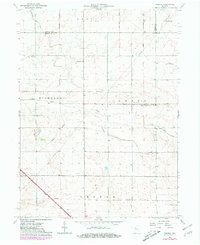
1962 Map of Wadena
USGS Topo · Published 1963About this map
Benton County agriculture and transit dominate this 1962 landscape, where the prairie is carved by a sophisticated network of drainage infrastructure like Big Pine Creek Ditch and Owens Ditch. The settlement of Wadena serves as a local hub, featuring the Township Sch and proximity to the naturally winding Sugar Creek. The map records a transition in rail history, showing the active New York Central line running through Gravel Hill in the southwest, contrasted with an Old Railroad Grade further north. These linear features, alongside the Storage Bins at Lochiel, illustrate the grain-shipping economy of the mid-century Midwest. For those tracing family history, the Dehner Cem remains a fixed point in Richland township, providing a genealogical anchor amidst the rotating fields of Union and Center townships.
Find a feature on this map
23 named features on this map. Tap any name to fly to it.
Don’t see what you’re looking for? This feature index may not catch every label — zoom into the map to look around manually.
Map Details
Editions of this 1962 Wadena Map
2 editions found
Other maps of this area

1953 · Danville
USGS Topo · 1:250,000

1955 · Danville
USGS Topo · 1:250,000

1956 · Danville
USGS Topo · 1:250,000

1961 · Kentland
USGS Topo · 1:24,000

1962 · Mount Gilboa
USGS Topo · 1:24,000

1962 · Templeton
USGS Topo · 1:24,000

1962 · Boswell
USGS Topo · 1:24,000

1962 · Goodland
USGS Topo · 1:24,000

1962 · Earl Park
USGS Topo · 1:24,000
1962 · Fowler
USGS Topo · 1:24,000