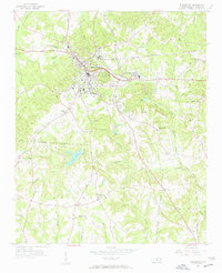
1956 Map of Wadesboro
USGS Topo · Published 1957About this map
Wadesboro serves as the central hub of this mid-1950s survey, showing a landscape defined by the intersection of major rail lines and industrial sites. The Seaboard Air Line and the Winston-Salem Southbound railroads converge near the heart of the community, supporting local industry at Wade Mills and connections to outlying areas like Gatewood Sta. The surrounding rural topography is deeply etched with a network of drainage branches, including Goulds Creek and Jones Creek, which separate dozens of family-named landmarks and rural congregations.
Find a feature on this map
46 named features on this map. Tap any name to fly to it.
Don’t see what you’re looking for? This feature index may not catch every label — zoom into the map to look around manually.
Map Details
Editions of this 1956 Wadesboro Map
3 editions found

Other maps of this area

1941 · Spartanburg
USGS Topo · 1:250,000

1942 · Troy
USGS Topo · 1:125,000

1942 · Rockingham
USGS Topo · 1:125,000

1953 · Florence
USGS Topo · 1:250,000

1953 · Raleigh
USGS Topo · 1:250,000

1953 · Spartanburg
USGS Topo · 1:250,000

1953 · Charlotte
USGS Topo · 1:250,000

1954 · Charlotte
USGS Topo · 1:250,000

1954 · Florence
USGS Topo · 1:250,000

1954 · Raleigh
USGS Topo · 1:250,000