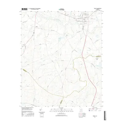
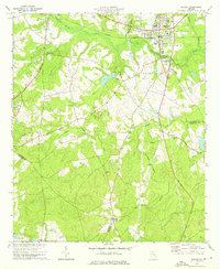
2017 Map of Wadley
USGS Topo · Published 2017About this map
Wadley serves as the primary hub of this East Georgia landscape, where a dense grid of streets like W Calhoun St and S Main St centers on the local rail infrastructure. The surrounding terrain is defined by the extensive drainage systems of Williamson Swamp Cr and its tributaries, creating a patchwork of wetlands and small water bodies such as Easterlin Lake and Rachels Pond. This 2017 survey highlights the tri-county border area where Jefferson, Emanuel, and Johnson counties meet amidst a rural network of named routes like Co Rd 187 and Coleman Chapel Rd.
Find a feature on this map
79 named features on this map. Tap any name to fly to it.
Don’t see what you’re looking for? This feature index may not catch every label — zoom into the map to look around manually.
Map Details
Editions of this 2017 Wadley Map
This is the sole edition of this map. No revisions or reprints were ever made.
Other maps of this area

1957 · Macon
USGS Topo · 1:250,000

1958 · Macon
USGS Topo · 1:250,000

1964 · Macon
USGS Topo · 1:250,000

1971 · Dellwood
USGS Topo · 1:24,000

1971 · Summertown
USGS Topo · 1:24,000
1973 · Louisville South
USGS Topo · 1:24,000
1973 · Davisboro SE
USGS Topo · 1:24,000
1973 · Old Town
USGS Topo · 1:24,000

1973 · Colemans Lake
USGS Topo · 1:24,000
1973 · Wadley
USGS Topo · 1:24,000