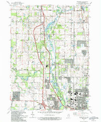
1993 Map of Wadsworth
USGS Topo · Published 1993About this map
The Des Plaines River Forest Preserve anchors this landscape in northern Lake County, where the river winds past a series of established settlements and expanding communities. During the early 1990s, the area around Wadsworth and Gurnee shows the persistent imprint of nineteenth-century agricultural crossroads like Rosecrans and Millburn. The infrastructure of the Tri-State Tollway and the Chicago Milwaukee St Paul and Pacific railroad corridor cut north-south across the glacial terrain, bridging the gap between rural townships and the growing Waukegan municipal boundary.
Find a feature on this map
66 named features on this map. Tap any name to fly to it.
Don’t see what you’re looking for? This feature index may not catch every label — zoom into the map to look around manually.
Map Details
Editions of this 1993 Wadsworth Map
2 editions found
Other maps of this area

1892 · Racine
USGS Topo · 1:62,500

1893 · Silver Lake
USGS Topo · 1:62,500

1905 · Racine
USGS Topo · 1:62,500

1906 · Silver Lake
USGS Topo · 1:62,500

1906 · Waukegan
USGS Topo · 1:62,500

1908 · Waukegan
USGS Topo · 1:62,500

1920 · Grays Lake
USGS Topo · 1:62,500

1923 · Grays Lake
USGS Topo · 1:62,500

1954 · Rockford
USGS Topo · 1:250,000

1955 · Rockford
USGS Topo · 1:250,000