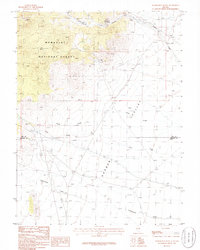
1985 Map of Wadsworth
USGS Topo · Published 1986About this map
Wadsworth Ranch sits tucked into a canyon at the northern edge of this high-desert basin, marking one of the few permanent settlements in a landscape defined by seasonal drainages and mining activity. The terrain transitions from the wooded slopes of the Humboldt National Forest down into the broad expanse of Garden Valley. This 1980s field check records a series of resource extraction points including several prospects, a Gravel Pit, and a Mine Shaft near Cherry Creek. Industrial infrastructure is visible through the presence of an Aboveground Pipeline and a remote Landing Strip. The map also captures the political geography of the region, showing the boundary between Nye Co and Lincoln Co where it crosses the arid plains of Sand Creek and Pine Creek.
Find a feature on this map
17 named features on this map. Tap any name to fly to it.
Don’t see what you’re looking for? This feature index may not catch every label — zoom into the map to look around manually.
Map Details
Editions of this 1985 Wadsworth Map
3 editions found
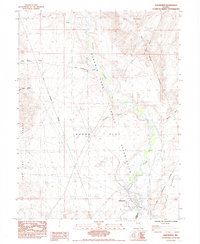
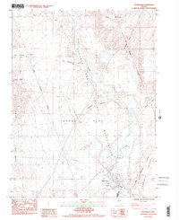
Other maps of this area

1890 · Wadsworth
USGS Topo · 1:125,000

1892 · Wadsworth
USGS Topo · 1:125,000

1894 · Wadsworth
USGS Topo · 1:125,000

1957 · Fireball Ridge
USGS Topo · 1:62,500

1957 · Two Tips
USGS Topo · 1:62,500

1957 · Wadsworth
USGS Topo · 1:62,500

1957 · Nixon
USGS Topo · 1:62,500

1957 · Reno
USGS Topo · 1:250,000

1959 · Reno
USGS Topo · 1:250,000

1960 · Reno
USGS Topo · 1:250,000