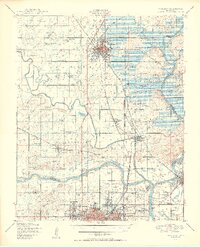
1950 Map of Wagoner
USGS Topo · Published 1950About this map
The confluence of the Verdigris River, Neosho River, and Arkansas River serves as the focal point of this Oklahoma survey, highlighting a transformative era for the region's hydraulic landscape. A significant portion of the river system is shown in transition, with the Fort Gibson Reservoir (Under Construction) poised to reshape the shoreline. The map documents an intricate network of rural education and social infrastructure, featuring the Bacone College campus and the Murrow Ind Orphans Home south of Wagoner.
Find a feature on this map
86 named features on this map. Tap any name to fly to it.
Don’t see what you’re looking for? This feature index may not catch every label — zoom into the map to look around manually.
Map Details
Editions of this 1950 Wagoner Map
2 editions found

Other maps of this area

1896 · Okmulgee
USGS Topo · 1:125,000

1896 · Pryor
USGS Topo · 1:125,000

1900 · Okmulgee
USGS Topo · 1:125,000

1901 · Muscogee
USGS Topo · 1:125,000

1901 · Claremore
USGS Topo · 1:125,000

1901 · Pryor
USGS Topo · 1:125,000

1905 · Muscogee
USGS Topo · 1:125,000

1914 · Claremore
USGS Topo · 1:125,000

1916 · Claremore
USGS Topo · 1:125,000

1946 · Fort Smith
USGS Topo · 1:250,000