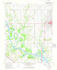
1974 Map of Wagoner West
USGS Topo · Published 1978About this map
The confluence of the Verdigris River and the meandering Old Channel anchors this mid-1970s landscape just west of the growing hub of Wagoner. The map illustrates a region transitioning between its traditional agricultural roots and a developing recreational infrastructure, evidenced by the Afton Landing Recreation Area and Tullahassee Loop Recreation Area along the water. Older rural community landmarks remain visible, such as Sandtown Ch and Star Sch, alongside the industrial presence of an Oil Field and numerous Oil Wells. The rail infrastructure is well-defined, showing the intersection of the Missouri Pacific and the Missouri Kansas Texas railroads. This network, combined with the Muskogee Toll Road Turnpike, highlights the area's importance as a transportation corridor connecting local resources to the broader Oklahoma region.
Find a feature on this map
36 named features on this map. Tap any name to fly to it.
Don’t see what you’re looking for? This feature index may not catch every label — zoom into the map to look around manually.
Map Details
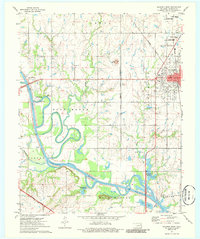
Editions of this 1974 Wagoner West Map
2 editions found
Other maps of this area

1896 · Okmulgee
USGS Topo · 1:125,000

1896 · Pryor
USGS Topo · 1:125,000

1900 · Okmulgee
USGS Topo · 1:125,000

1901 · Muscogee
USGS Topo · 1:125,000

1901 · Claremore
USGS Topo · 1:125,000

1901 · Pryor
USGS Topo · 1:125,000

1905 · Muscogee
USGS Topo · 1:125,000

1914 · Claremore
USGS Topo · 1:125,000

1916 · Claremore
USGS Topo · 1:125,000

1946 · Fort Smith
USGS Topo · 1:250,000