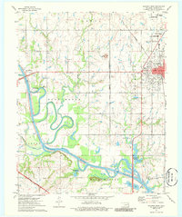
1974 Map of Wagoner West
USGS Topo · Published 1986About this map
The Verdigris River snakes through this 1974 landscape, defined by a complex network of old river channels and the infrastructure of the Oklahoma river-and-rail economy. The eastern edge is dominated by Wagoner, where the Missouri Pacific and Missouri Kansas and Texas railroads intersect, signaling the town's historical importance as a transit hub. Near the city limits, local history is preserved at Elmwood Cem and the Hosp.
Find a feature on this map
40 named features on this map. Tap any name to fly to it.
Don’t see what you’re looking for? This feature index may not catch every label — zoom into the map to look around manually.
Map Details
Editions of this 1974 Wagoner West Map
2 editions found
Other maps of this area

1896 · Okmulgee
USGS Topo · 1:125,000

1896 · Pryor
USGS Topo · 1:125,000

1900 · Okmulgee
USGS Topo · 1:125,000

1901 · Muscogee
USGS Topo · 1:125,000

1901 · Claremore
USGS Topo · 1:125,000

1901 · Pryor
USGS Topo · 1:125,000

1905 · Muscogee
USGS Topo · 1:125,000

1914 · Claremore
USGS Topo · 1:125,000

1916 · Claremore
USGS Topo · 1:125,000

1946 · Fort Smith
USGS Topo · 1:250,000