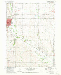
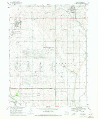
1969 Map of Wahoo East
USGS Topo · Published 1971About this map
Wahoo serves as the primary hub of this 1969 agricultural and educational landscape, featuring the campus of John F Kennedy College and the Wahoo Municipal Airport. The town is a confluence of regional transport, where the Chicago and North Western, Union Pacific, and Burlington Northern railroads intersect near the center of the sheet. This transport network supported a bustling local economy evidenced by the Powerplant, Fairground, and various industrial Sandpits along the waterways.
Find a feature on this map
44 named features on this map. Tap any name to fly to it.
Don’t see what you’re looking for? This feature index may not catch every label — zoom into the map to look around manually.
Map Details
Editions of this 1969 Wahoo East Map
2 editions found
Other maps of this area

1893 · Fremont
USGS Topo · 1:125,000

1896 · Fremont
USGS Topo · 1:125,000

1899 · Wahoo
USGS Topo · 1:125,000

1955 · Fremont
USGS Topo · 1:250,000

1957 · Fremont
USGS Topo · 1:250,000

1958 · Fremont
USGS Topo · 1:250,000

1968 · Leshara
USGS Topo · 1:24,000
1969 · Malmo
USGS Topo · 1:24,000
1969 · Ashland West
USGS Topo · 1:24,000
1969 · Mead
USGS Topo · 1:24,000