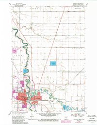
1964 Map of Wahpeton
USGS Topo · Published 1988About this map
Wahpeton and Breckenridge sit at the strategic confluence where the Bois de Sioux River and the Otter Tail River merge to form the Red River of the North. This mid-century survey documents a dense institutional landscape in the twin cities, including the State School of Science, the Wahpeton Indian Sch, and several local schools like Richards Sch. The riverbanks are defined by recreation and industry, from the Bois de Sioux Country Club to the local Powerplant.
Find a feature on this map
40 named features on this map. Tap any name to fly to it.
Don’t see what you’re looking for? This feature index may not catch every label — zoom into the map to look around manually.
Map Details
Editions of this 1964 Wahpeton Map
3 editions found
Other maps of this area

1904 · Wahpeton
USGS Topo · 1:125,000

1919 · Rothsay
USGS Topo · 1:62,500

1951 · Rothsay
USGS Topo · 1:62,500

1951 · Campbell
USGS Topo · 1:62,500

1953 · Fargo
USGS Topo · 1:250,000

1956 · Fargo
USGS Topo · 1:250,000

1964 · Fairmount NW
USGS Topo · 1:24,000

1964 · Dwight
USGS Topo · 1:24,000

1964 · Wahpeton
USGS Topo · 1:24,000
1973 · Abercrombie
USGS Topo · 1:24,000