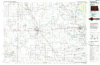
1985 Map of Wahpeton
USGS Topo · Published 1986About this map
The Red River of the North and the Bois de Sioux River form the winding boundary between North Dakota and Minnesota, anchoring a landscape where the Red River Valley meets the rolling lake country to the east. The twin cities of Wahpeton and Breckenridge serve as the central hub, situated at the confluence where the Otter Tail River joins to form the northward-flowing Red River. This mid-1980s planimetric survey illustrates a region defined by its rail network, with the Burlington Northern and Soo Line tracks connecting numerous smaller agricultural settlements like Hankinson, Fairmount, and Fergus Falls.
Find a feature on this map
106 named features on this map. Tap any name to fly to it.
Don’t see what you’re looking for? This feature index may not catch every label — zoom into the map to look around manually.
Map Details
Editions of this 1985 Wahpeton Map
2 editions found
Other maps of this area

1895 · Fargo
USGS Topo · 1:125,000

1895 · Casselton
USGS Topo · 1:125,000

1897 · Fargo
USGS Topo · 1:125,000

1897 · Casselton
USGS Topo · 1:125,000

1904 · Wahpeton
USGS Topo · 1:125,000

1907 · Wyndmere
USGS Topo · 1:125,000

1910 · Wendell
USGS Topo · 1:62,500

1911 · Barrett
USGS Topo · 1:62,500

1911 · Herman
USGS Topo · 1:62,500

1912 · Vergas
USGS Topo · 1:62,500